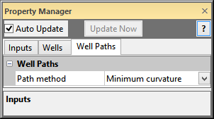
The WellData module Well Paths page contains the method for how to calculate the well paths. All wells in the WellData container have the same properties applied. To open the Well Paths page, click on the WellData module in the Network Window. In the Property Manager, click on the Well Paths tab.

Compute the well paths for all wells that have tops,
azimuth, and inclination information.
The Well
Paths section contains options for converting Measured Depth (MD),
Azimuth, and Inclination information to X, Y, and Z data. Click on the
 to expand the well path section
to compute the paths for the wells. Click the
  to compress
the well path information. If the WellData
module does not have Measured Depth, Azimuth, and Inclination data for
at least one well, then the Path method
is disabled, because no well paths are computed.
The Path method contains various methods for computing the well paths for Measured Depth (MD), Azimuth, and Inclination well data. Available options are Average angle, Balanced tangential, Minimum curvature, and Tangential. To change the option, click on the existing method and select the desired method from the list. The most commonly used method is Minimum curvature.
Each method creates a mathematical approximation of the true X, Y, and Z value along the well path. Each technique is used in different circumstances. The technical aspects of each method are found in:
"Bulletin on Directional Drilling Survey Calculation Methods and Terminology," American Petroleum Institute (API) Bulletin D20, December 31, 1985.
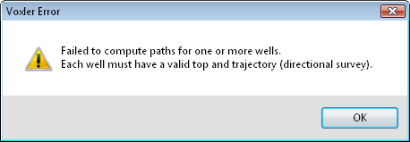
A warning message will appear in two instances:
when opening a Voxler Project VOXB file with incomplete directional survey data
when connecting the WellData module to a Data Source module that contains incomplete directional survey data

A warning appears if all wells do not have trajectory or top information.
Click OK on the warning. The wells that have valid top and trajectory information will have the paths computed. Some wells will not have computed paths. For these wells, you should examine and update the top and trajectory information for that well and reload.
See Also