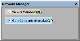
Select a point data set in the Network Manager
to display its properties in the Property Manager.
Point source modules are created when a previous version (Voxler 3 or older) Voxler project file (*.voxb) containing point source modules is opened in Voxler 4 with the File | Open command. A point source module will be created when using the File | Import command to import a points data file that is NOT in a tabular file format, such as LAS LiDAR or some KML files. A Point source module is also created when importing a SEGY data file with Point cloud as the Import format.
In Voxler 4, the Data Source module is created for point data in a tabular file format, such as Excel XLS and XLSX, DAT, or CSV files.
Defined from the point coordinates located in the data file.
Depending on the type of data imported, the point module may be connected to the Graphics Output Modules or the Computational Modules. An Info Module may also be connected to the output node.
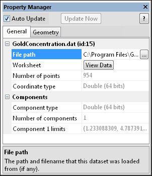
Click on the point source module in the Network Manager to select it. The Property Manager displays various statistics about the loaded data set, the point source module. This is the same information displayed by the Info module. The point source module properties are described below.

Select a point data set in the Network
Manager
to display its properties in the Property
Manager.
The point source module contains the following tabs in the Property Manager:
General

The information displayed for point set data
is the same as that shown in the Info module.
The path of the loaded source file appears next to File
path. Click the  button to the right of the file
path to display the Open
dialog. The Open dialog
appears. The currently loaded file name is display in the File name section. The path for
the current file is shown. Click the Open
button to reload the current file. This can be used to update the network
after the data file has been modified.
Alternatively browse and select a new file. Click the Open button to load the new file. The dialog closes and the selected file is loaded. If the new file does not display geometry information, a warning message will appear and the original file remains.
Click the View Data button to display the data in a worksheet view. The Data View dialog opens.
The Number of points displays the number of points in the data file. This property cannot be changed.
The Coordinate type details the type of data storage associated with the X, Y, and Z directions. This property cannot be changed.
The Component type details the type of data storage associated with each data component. This property cannot be changed.
The Number of components item details the number of data components per data point. This property cannot be changed.
The Component limits display the minimum and maximum values for the component. Each component is listed separately, if the input contains more than one component. This property cannot be changed.
See Also